Tai Tong Orienteering Course
Maps
(Printing on A4 size paper is recommended for accurate scaling.)
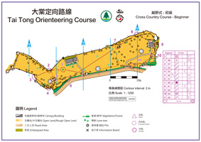
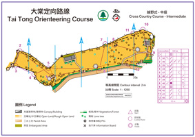
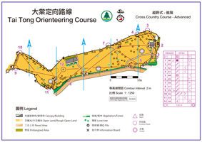
Cross Country Courses
| Detail | Level | ||
|---|---|---|---|
| Beginner | Intermediate | Advanced | |
|
Length* (km) |
0.4 |
0.6 |
0.8 |
|
Climb (m) |
0 |
0 |
0 |
|
No. of Controls |
11 |
12 |
12 |
|
Map (click to download) |
|||
* Measured as straight line distance between controls.
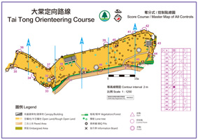
Score Course / Master Map
Total no. of controls: 16
Start and Finish Location
How to get there:
Take MTR bus route no. K66 at MTR Long Ping Station / Yuen Long Town or red minibuses at Hung Min Court and get off at Tai Tong Shan Road bus station. Walk along Tai Tong Shan Road uphill for about 25 minutes to reach Tai Tong Barbecue Site No. 1.
For more information on orienteering, click here.


